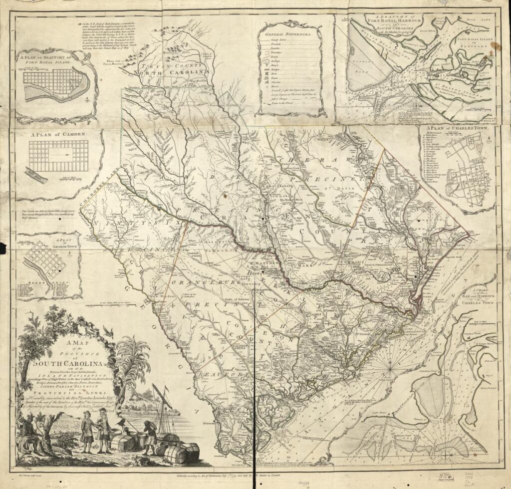
Cook, J., Bowen, T. & Parker, H. (1773) A map of the province of South Carolina with all the rivers, creeks, bays, inlets, islands, inland navigation, soundings, time of high water on the sea coast, roads, marshes, ferries, bridges, swamps, parishes, churches, towns, townships, county, parish, district, and provincial lines. [London Sold by H. Parker] [Map] Retrieved from the Library of Congress, https://www.loc.gov/item/74692124/.